Arctic Great Rivers
Yenisey
The Yenisey River has a mean annual discharge of 673 km3/year. It is the largest Arctic river by annual discharge and the 5th largest globally. There are multiple dams on the main-stem of the Yenisey River and its tributaries.
The Yenisey’s watershed is 2.5 million km2. Permafrost is present in 88% of the watershed, with 33% of the watershed containing continuous permafrost. Over 8 million people live in the Yenisey River watershed, 2nd most among Arctic watersheds.
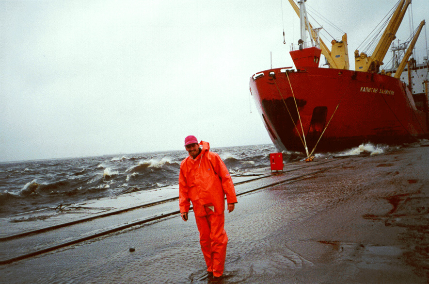
ArcticGRO water sampling on the Yenisey River is done at Dudinka (69.38°N, 86.15°E). Yenisey sampling for ArcticGRO III is coordinated by Alexander Zhulidov and Tatiana Gurtovaya of CPPI-S (Rostov-on-Don, Russia), and is done by Alexander Smirnov.
Yenisey River discharge is measured at Igarka (67.43°N, 86.48°E), under the direction of the Arctic and Antarctic Research Institute.
Lena
The Lena River has a mean annual discharge of 581 km3/year. It is the 2nd largest Arctic river by annual discharge and the 6th largest globally. There are no dams on the main-stem of the Lena, but there is a dam on the Viluy River, one of the Lena’s main tributaries.
The Lena’s watershed is 2.4 million km2, of which 77% is underlain by continuous permafrost. Approximately 1.07 million people live in the Lena watershed, so the population density of the watershed is about 0.4 people/km2. Yakutsk (population 270,000) is the largest city in the watershed. In fact, Yakutsk is the world’s largest city built entirely on permafrost.
ArcticGRO water sampling on the Lena River is done at Zhigansk (66.77°N, 123.37°E). Lena sampling for ArcticGRO III is coordinated by Alexander Zhulidov and Tatiana Gurtovaya of CPPI-S (Rostov-on-Don, Russia), and is done by Mikail Suslov.
Lena River discharge is measured at Kyusyur (70.68°N, 127.39°E), under the direction of the Arctic and Antarctic Research Institute.
Ob’
The Ob’ River has a mean annual discharge of 427 km3/year. It is the 3rd largest Arctic river by annual discharge and the 13th largest globally. There is one dam on the main-stem of the Ob’, at Novosibirsk, as well as two dams on the Irtysh River, one of the Ob’s main tributaries.
The Ob’s watershed is 2.95 million km2. Permafrost is present in 26% of the watershed, but only 2% of the watershed is underlain by continuous permafrost. Over 28 million people live in the Ob’ River’s watershed, far more than any other Arctic river watershed.
ArcticGRO water sampling on the Ob’ River is done at Salekhard (66.63°N, 66.60°E). Ob’ sampling for ArcticGRO III is coordinated by Alexander Zhulidov and Tatiana Gurtovaya of CPPI-S (Rostov-on-Don, Russia), and is done by Sergey Pavlov.
Ob’ River discharge is measured at Salekhard (66.63°N, 66.60°E), under the direction of the Arctic and Antarctic Research Institute.
Mackenzie
The Mackenzie River has a mean annual discharge of 316 km3/year. It is the 4th largest Arctic river by annual discharge and the 18th largest globally.
The Mackenzie’s watershed area is 1.8 million km2. Permafrost is present in 82% of the watershed, with 16% classified as continuous and 29% classified as discontinuous. Approximately 465,00 people live in the Mackenzie River’s watershed.
ArcticGRO water sampling on the Mackenzie River is done at Tsiigehtchic (67.45°N, 133.74°W). Mackenzie sampling for ArcticGRO III is coordinated by the Aurora Research Institute (Inuvik), and is done by Edwin Amos and Andrew Gordon.
Mackenzie River discharge is measured by the Water Survey of Canada at Tsiigehtchic (67.45°N, 133.74°W).
Yukon
The Yukon River has a mean annual discharge of 208 km3/year. It is the 5th largest Arctic river by annual discharge and the 22nd largest globally.
The Yukon’s watershed area is 0.83 million km2. The vast majority of the watershed is underlain by permafrost, 23% of which is classified as continuous. Approximately 146,000 people live in the Yukon River’s watershed, with Fairbanks (regional population about 100,000) being by far the largest city in the watershed.
ArcticGRO water sampling on the Yukon River is done at Pilot Station (61.93°N, 162.88°W). Yukon sampling for ArcticGRO III is coordinated by Edda Mutter of the Yukon River Intertribal Watershed Council (Anchorage), and is done by Edda and staff of the Pilot Station Traditional Council including Robert Meyer and MaryAnn Fidel. Martin Kelly, Tribal Administrator in Pilot Station, is also our key partner.
Yukon River discharge is measured by the United States Geological Survey (USGS) at Pilot Station (61.93°N, 162.88°W).
Kolyma
The Kolyma River has a mean annual discharge of 136 km3/year. It is the 6th largest Arctic river by annual discharge and the 29th largest globally. There is one dam on the main-stem of the Kolyma River.
The Kolyma’s watershed is 0.65 million km2. It is Earth’s largest watershed that is 100% continuous permafrost. Less than 80,000 people live in the Kolyma watershed, fewest among the ArcticGRO rivers.
ArcticGRO water sampling on the Kolyma River is done at Cherskiy (68.75°N, 161.30°E). Kolyma sampling for ArcticGRO III is coordinated by staff of the Northeast Science Station (Cherskiy), and is conducted by Nikita Zimov and Gabaidulin Alexander.
Kolyma River discharge is measured at Kolymsk (68.73°N, 158.72°E), under the direction of the Arctic and Antarctic Research Institute.
References
Watershed Characteristics
Holmes, R. M., M. T. Coe, G.J. Fiske, T. Gurtovaya, J. W. McClelland, A. I. Shiklomanov, R. G. M. Spencer, S. E. Tank, A. V. Zhulidov. 2013. Climate change impacts on the hydrology and biogeochemistry of Arctic Rivers, in Global Impacts of Climate Change on Inland Waters, edited by C. R. Goldman, M. Kumagai, and R. D. Robarts, Wiley. [Table 1.1]
Holmes, R. M., J. W. McClelland, B. J. Peterson, S. E. Tank, E. Bulygina, T. I. Eglinton, V. V. Gordeev, T. Y. Gurtovaya, P. A. Raymond, D. J. Repeta, R. Staples, R. G. Striegl, A. V. Zhulidov, and S. A. Zimov. 2012. Seasonal and annual fluxes of nutrients and organic matter from large rivers to the Arctic Ocean and surrounding seas. Estuaries and Coasts 35:369-382, doi: 10.1007/s12237-011-9386-6. [Table 1]
Dams
McClelland, J. W., R. M. Holmes, B. J. Peterson, and M. Stieglitz. 2004. Drivers of increasing river discharge in the Eurasian Arctic: considerations of dams, permafrost thaw, and fires as potential agents of change. Journal of Geophysical Research 109:D18102, doi: 10.1029/2004JD004583. [Table 1]

 info@arcticgreatrivers.org


