info@arcticgreatrivers.org
Since 2003
ArcticGRO tracks the water and chemistry that the largest Arctic rivers carry to the Arctic Ocean.
Consistent water sampling on the six largest Arctic rivers, and daily discharge for 15 rivers. All data are free to use by anyone, for any purpose.
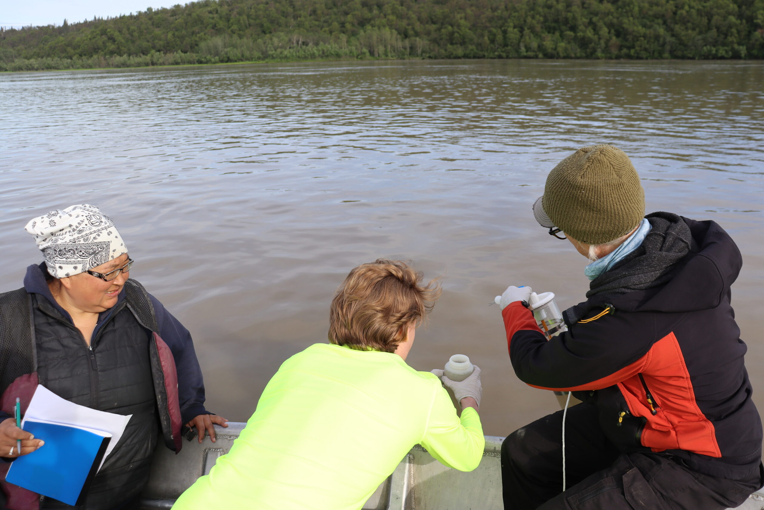
Yukon River near Pilot Station. August 2015. Photo by John Schade.
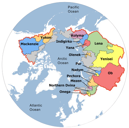
The six rivers ArcticGRO samples drain two-thirds of the Arctic Ocean watershed, so their chemistry tracks change across permafrost landscapes in Russia, Canada and Alaska. (Tank et al. 2023, Nature Geoscience)
Why Arctic rivers matter
Changes in river flow and chemistry reflect what is happening across vast, rapidly warming watersheds, and shape the coastal ocean that receives them. More about ArcticGRO
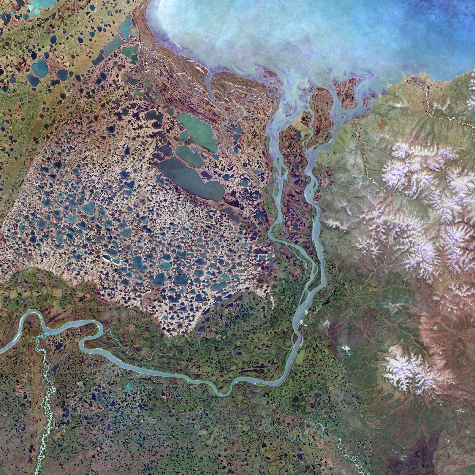
Freshwater
Rivers deliver freshwater that shapes Arctic Ocean salinity, sea ice and circulation.
Carbon and nutrients
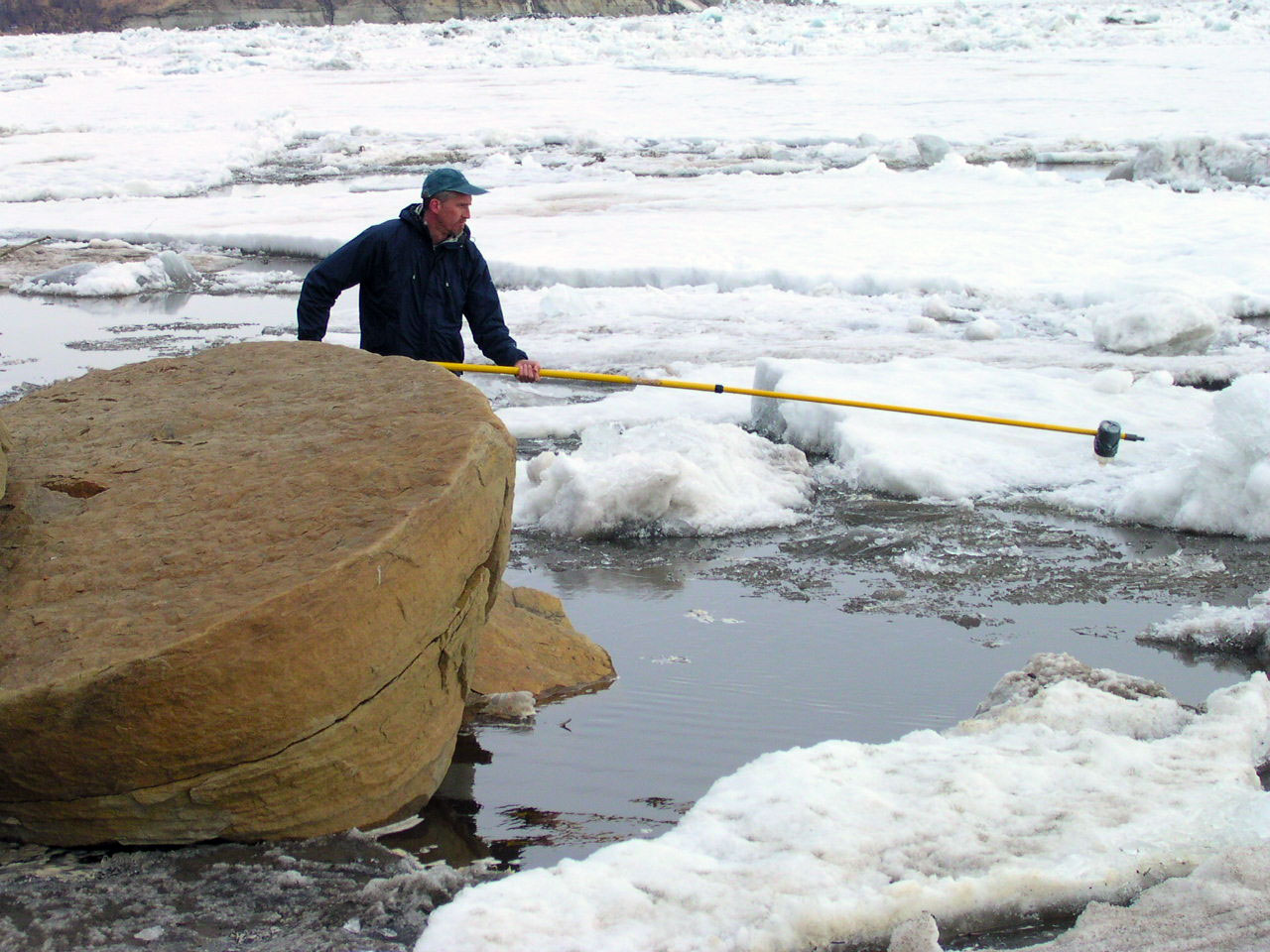
Rivers carry carbon from thawing permafrost, and nutrients, to coastal seas.
A climate signal
Long-term records show discharge from large Eurasian Arctic rivers increasing (Peterson et al. 2002).
Latest year
2025 on the Ob': spring flood peaked at 38,600 m³/s on 17–18 June
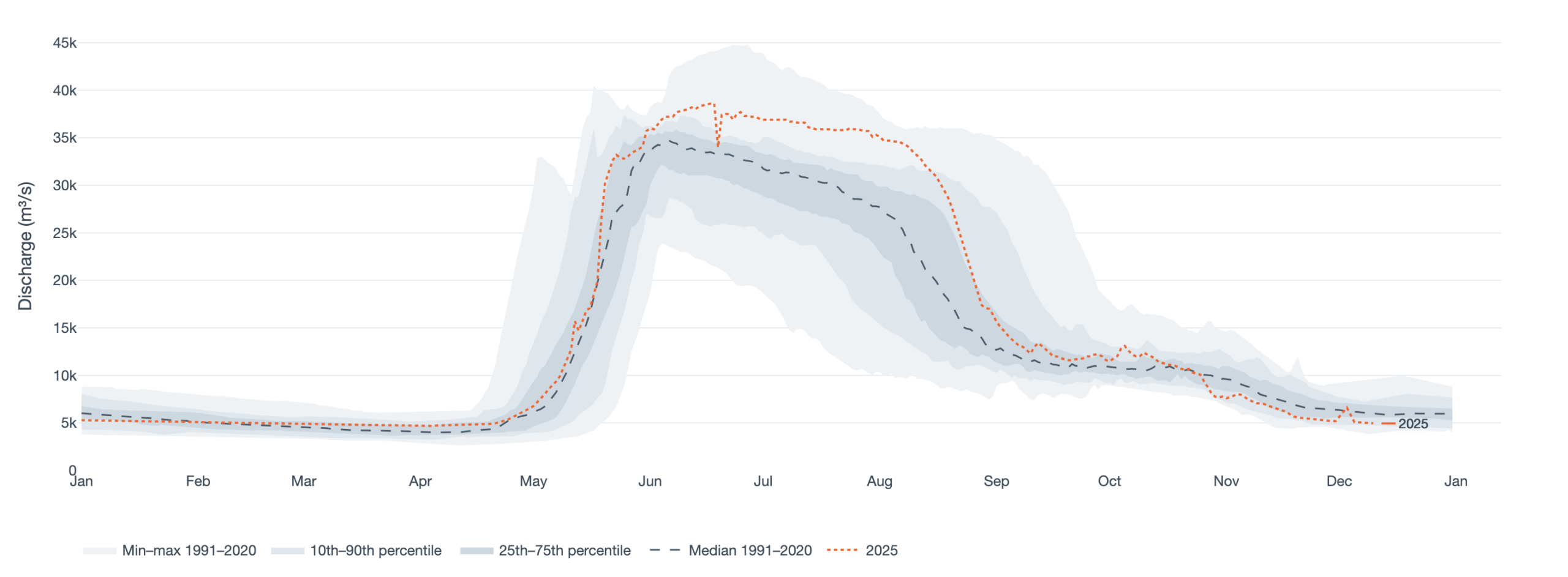
Daily discharge, m³/s. Data updated 10 December 2025 · Roshydromet / AARI provisional data.
Where we work
Water chemistry is sampled near the mouths of the six largest Arctic rivers. Daily discharge comes from 17 gauges on 15 rivers, operated by Roshydromet, the U.S. Geological Survey and the Water Survey of Canada.
More than twenty years of sampling, through every season
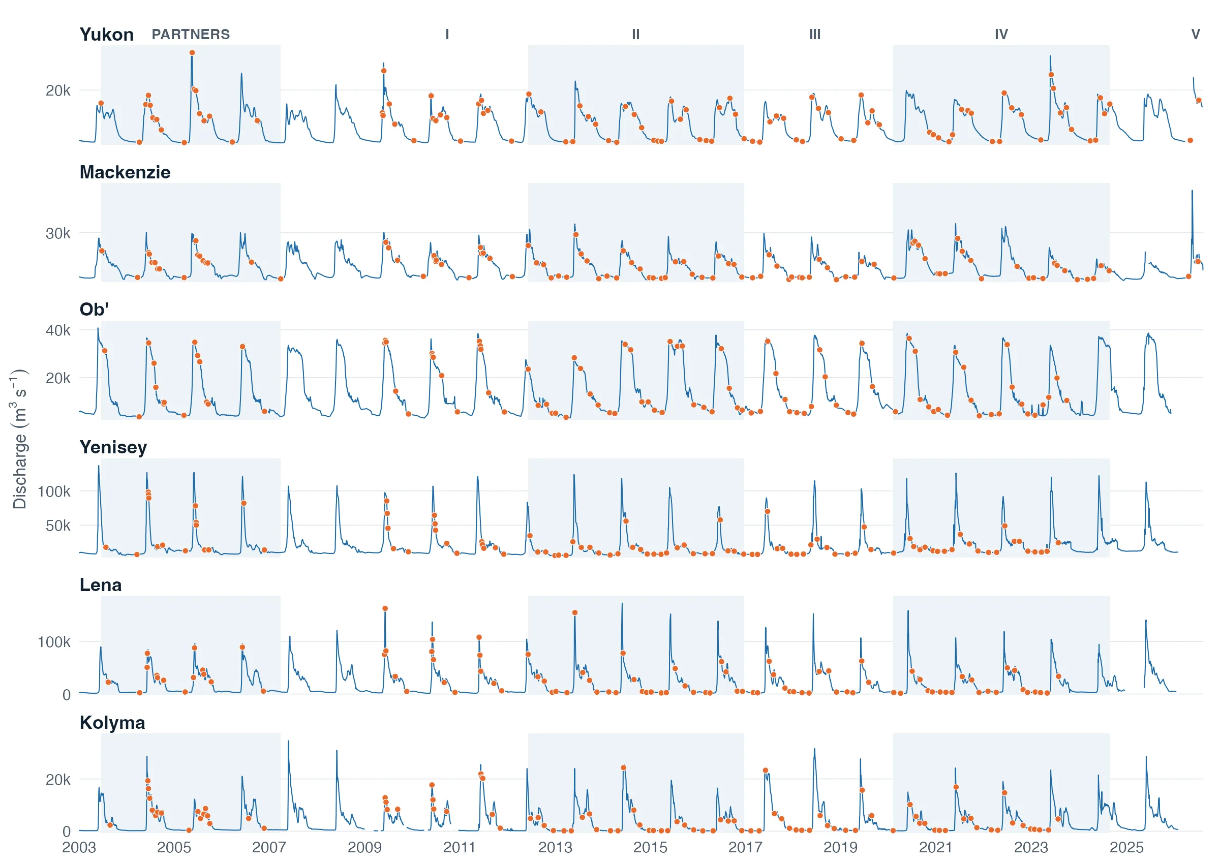
Tap or click the chart to open it full size. Explore discharge and chemistry for each river.
Data updates